
The Overbigging enclosure – an ‘elaborate and rather enigmatic monument’

By Sigurd Towrie

Although our knowledge of the sites on and around the Ness of Brodgar has come on in leaps and bounds, some remain frustratingly unclear.
One that falls into that category is a large ditch-and-bank enclosure, near Overbigging, Stenness, about 480 metres north-west of Maeshowe.
First recorded by aerial photography in 1965 [1], the site was not investigated until the start of the 21st century, when the UHI Archaeology Institute geophysically surveyed 285 hectares of the Heart of Neolithic Orkney World Heritage Site.
This revealed:
Centuries of agricultural work have reduced the monument to a low, oval earthwork, barely visible from ground-level. It measures 68 metres across (NNW to SSE) by 65 metres and was surrounded by a three-metre-wide ditch, with an entrance, about eight metres wide, at the SSE.
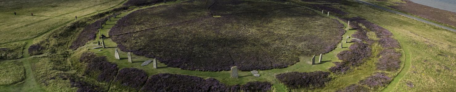
To put its size into context, the ditch surrounding the Stones of Stenness had an approximate diameter of 44 metres, the Ring of Bookan 45m by 40m, while Maeshowe’s oval enclosure is c.106 metres by 93 metres.

Although little known today, Overbigging was:
It sits at the end of a natural ridge, the ground sloping gently downwards around the south-western end. Another low ridge runs north-west to south-east towards Maeshowe:
Overbigging’s interior was further defined by a substantial bank, 8.5-9.5 metres across, with a six-metre-wide entrance at the SSE. This enclosed an area c.70 square metres.
If we follow the classic typology, it seems we have a Class One henge, featuring a single entrance, single bank and a single ditch circuit. But although the Overbigging enclosure fits the accepted classification nicely, it does not really tell us much about its role or purpose.
What we can say, based on the magnetometry scans, is that it was probably not a settlement site. Which, based on the nature of the surrounding landscape is probably not surprising.
A four-metre-wide pit, west of the enclosure’s centre, was visible in the geophysical scan results, as well as several smaller pits inside and outside. [2]
Two of these, at the southern end, appeared to correspond with a line of five pits noted by aerial survey in 1965. Although it would require excavation to confirm it is tempting to consider whether these represent post-holes or sockets for standing stones:
With Overbigging we face the same questions encountered at other so-called henge sites. These surround the timing of the ditch and bank. Were they primary or a much later addition? Perhaps created to contain or emphasise an earlier feature?

If the ditch and bank were specifically to enclose something, what was it?
That we do not know, but just inside the entrance is a raised area, almost square-shaped, and measuring about 25 metres across. Without excavation, what this represents is unclear, but it does seem there was something substantial within. Two curvilinear features were also noted but these may reflect the natural topography.
Are we looking at another monumental Ness-type building, as has been proposed for both the Stones of Stenness and the Ring of Bookan? Or something entirely different?
And how does Overbigging relate to Maeshowe? Was it contemporary or a much later addition to the Neolithic landscape?
Despite its obvious henge-like features and proximity to Maeshowe, the nature of the entrance arrangement is reminiscent of Iron Age enclosures:
With this site, we have to roll out our regular post conclusion…
It will take excavation to answer the questions.
Notes
- [1] Carried out by J.K.S. St Joseph, of the Cambridge University Committee for Aerial Photography (CUCAP)
- [2] Brend, A., Card, N., Downes, J., Edmonds, M. and Moore, J. (2020) Landscapes Revealed: Geophysical Survey in the Heart of Neolithic Orkney World Heritage Area 2002-2011. Oxbow Books, Oxford.


