
The knowes, howes and barrows around the Ring of Brodgar

By Sigurd Towrie
Although the Ring of Brodgar dominates the surrounding area, the stone circle is but the tip of an archaeological iceberg.
Erected in the Late Neolithic, it is clear, and perhaps not surprising, that the ring remained a site of special significance well into the Bronze Age. We know this because of the number of Bronze Age barrows that cluster around it.
These are in addition to four very large mounds – one of which is perhaps contemporary with the stone circle and another that may pre-date it.

Because of the barrow cemeteries raised around them, we know that Neolithic sites across Orkney became a focus for Bronze Age activity. Being interred in the vicinity of a monument was clearly desirable and probably had social connotations – connecting the deceased, and perhaps more importantly their surviving families, to those who had gone before and bringing into play notions of belonging, ancestry and links to events from a semi-legendary past.
The largest of the mounds around the Ring of Brodgar are the four known as Salt Knowe [1], Fresh Knowe, South Knowe and Plumcake Mound – all of which were targeted by the antiquary James Farrer in the 19th century – first in 1854 and again in 1861. [2b] [7]
Salt Knowe

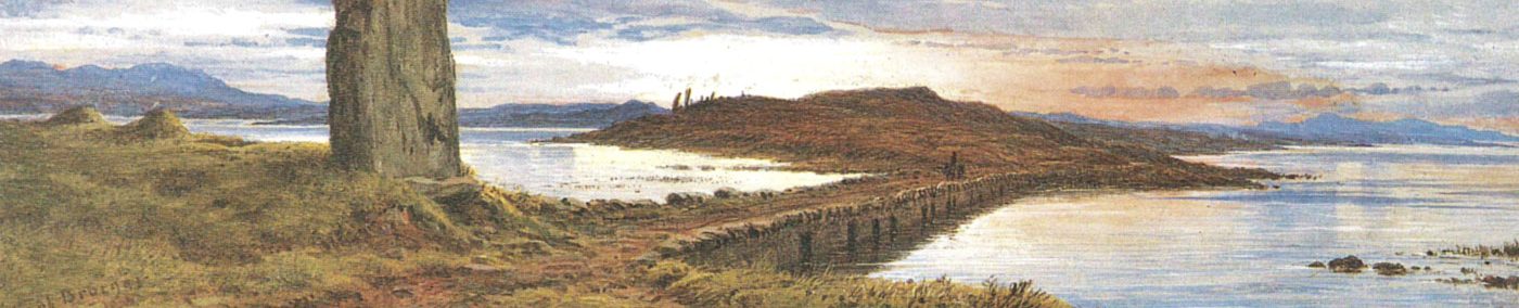
Prominent on flat ground 100 metres to the south-west of the Ring of Brodgar, Salt Knowe is arguably the most striking landscape feature around the stone circle.

Measuring around 37 metres by 33 metres and about five metres high, the mound’s position by the eastern shore of the brackish Stenness loch is undoubtedly the origin of its modern name. [1b]
The sheer size of Salt Knowe, matched only by Maeshowe, led to the long-standing belief that the mound housed a Neolithic chambered cairn. However, a combination of modern research and antiquarian “excavation” suggested this is not the case.
Ground-penetrating radar scans of the knowe, carried out by the UHI Archaeology Institute geophysics unit in 2008, showed that it appeared to be nothing more than a massive mound of earth, with no central structure.
A survey around the base, however, revealed a number of possible pits and a ditch. [2]
The 21st century findings tie in with an 1861 letter written to The Orcadian newspaper by the antiquarian James Farrer. Farrer, who was responsible for excavating Maeshowe, also delved into the tumuli around the Ring of Brodgar.
He wrote:
A year later, Farrer declared:
“Sections were made at right angles in both of the hillocks, and it was clearly ascertained that no building of any size could be concealed within.” [2b]
Despite the lack of internal structural remains, Farrer noted:
These removed stones may relate to the pits detected by the geophysical surveys and noted above.
There was a probable Bronze Age cist on top of the mound, but it is not clear when, or by whom, it was uncovered.
Salt Knowe was long assumed, like the other mounds around the Ring of Brodgar, to date to somewhere between 2500BC and 1500BC – a fairly broad-brush dating that takes in the end of the Late Neolithic and Early Bronze Age. The truth, however, is that we do not have a date for the mound, although it may be contemporary to the stone circle.


The modern survey work, together with Farrer’s findings, or rather lack of them, has led to the suggestion that Salt Knowe may simply be a monumental mound similar to several found in Late Neolithic complexes across Britain, e.g. Droughduil mound at Dunragit in Galloway, Knowlton Great Barrow in Dorset, the Hatfield Barrow at Marden, and Silbury Hill, near Avebury. [2]
The construction of Salt Knowe was a truly massive undertaking and the effort required to excavate and transport the building material – perhaps from the digging of the Brodgar ditch – speaks volumes.
The result was a prominent and highly visible platform on which “to speak, to see and to be seen”. [2]
As Professor Mark Edmonds pointed out, “even today, the presence of one or two figures on the summit never fails to draw the eye.” [3]


Despsite the lack of documented evidence, the discovery of silver artefacts in the 17th century has become firmly associated with Salt Knowe. Likewise, these lost objects are now generally regarded as being ring-money of Viking/Norse date.
Wallace’s A Description of the Isles of Orkney, published in 1693, states:
The fact Wallace specifically mentions the Brig o’ Brodgar and the “circle of high stones” strongly suggests he was referring to the Stones of Stenness and that the silver hoard came from the large mound at the south-eastern tip of the Ness – which has evidence of Iron Age activity in and around it. Why use the brig as a point of reference if you are referring to the Ring of Brodgar?
I also cannot help but wonder if the tales surrounding the treasure lay behind Farrer’s assault on the Brodgar tumuli.

Plumcake Mound
This mound, which gained its unfortunate name from early antiquarians attempting to describe its original shape, covered a slightly smaller area than the neighbouring Fresh Knowe, but today is nowhere near its height.

Situated to the north-east of the Ring of Brodgar, and beside the Harray loch, Plumcake Mound is a shadow of its former self. The ruins of what was once a substantial earthwork now measures around 22 metres in diameter and less than two metres in height.
Visiting in 1848, Lieutenant Thomas described it as a “tumulus of peculiar form” [5]:
According to Thomas, the mound had a diameter of c19 metres, stood 2.74 metres high and “had never been explored”. [5]
Its undisturbed state did not last long.

In 1854, James Farrer secured permission to dig into the mound. Assisting him was the Orcadian antiquarian George Petrie, who noted that someone had beaten them to it.
Unperturbed, Farrer pressed on, all but hacking Plumcake Mound in half in his hunt for treasure.
Documenting the operation, Petrie wrote:
That same afternoon, the diggers came across a cist “placed 5 or 6 feet southwards from the centre” [7]. The interior of the cist was 0.76m long, 0.6m wide and 0.64m deep. Inside was a steatite “urn” containing cremated bone [7].
The cremation deposit has been radiocarbon dated to 1745–1566BC [7b], placing the deposit firmly in the Bronze Age.
Steatite, or soapstone, does not outcrop in Orkney and the nearest source is Shetland. Imported and used in Orkney from the Early Bronze Age, its use in cremation urns suggests the material had some significance to Bronze Age Orcadians. In Shetland, steatite vessels served domestic and funerary roles but in Orkney all have been found in mortuary contexts. [8]
A second cist, roughly the same size, was found a short distance away. It contained a clay pot, also holding fragments of cremated bone. [7]
Within the body of the mound itself, the excavators found a broken stone pestle, and “a block of stone, with two rows of incised rings round it.” [7]
The Norse tradition…
The tumuli surrounding the Ring of Brodgar were long thought to be burial mounds of fallen viking warriors and associated with a 10th century conflict between Earl Havard hinn arsæli and his nephew Einar klining.
According to the Saga of Olaf Trygvesson, the earl perished at a place in Stenness “now called Hávar∂steigar”.

The placename Howardsty survived until the 19th century – and is discussed here – but there is no agreement as to what it was applied to.
Some accounts equated it with the Ring of Brodgar, others the land around it and, in some cases, the entire Ness.
What this meant, however, was that the saga account was taken as proof that the mounds were “the tombs of the early Scandinavians”. [5]
In 1851, for example, Lt Thomas had no doubt that “Earl Havard was buried beneath one of the Stenness tumuli”. [5]
The discovery of human remains within Plumcake mound was subsequently regarded as confirmation of a viking presence on the Ness – although we now know they probably date from the Bronze Age.
Fresh Knowe


Lying to the east of the Ring of Brodgar, and across the modern road that bisects the Ness, is the mound known as the Fresh Knowe. Today, it remains an imposing part of the landscape.
The mound is elliptical in shape, and measures 38 metres by 26 metres across, and 5.7 metres high. In the 19th century, Petrie noted there was a ridge along the top of the mound, about 6.7 metres long.
Farrer initially targeted Fresh Knowe for investigation in 1854, at the same time he opened the Plumcake mound. Despite “a very considerable cut” made into the north end, nothing was found. [7]
An opinion prevalent at the time was that the mound was nothing more than the pile of earth and stone – made from the material removed during the digging of the Ring of Brodgar’s ditch.

Petrie strongly disagreed, arguing that there was “evidence of far more care in its construction than was likely to be expended on a mere heap of rubbish”. [7]
Farrer returned to the knowe in 1861, concluding that “further examination … did not encourage the belief that it was sepulchral.” [2b]
His initial thoughts disproved, Petrie conceded, in an unpublished note, that there was nothing within.
That said, Fresh Knowe, like Salt Knowe, was found to have once had building stone around its base.
Again, the mound’s title is fairly modern, presumably coined because of the mound’s location beside the freshwater loch. In 1851, Orcadian George Petrie does not give it a name – referring to it simply as the elliptical mound.
Writing in 1892, George Marwick, another Orcadian, from the neighbouring parish of Sandwick, referred to it as “Farrar’s Knowe” (sic) because of the “gentleman of that name [who had] opened it some years ago.” [9]


South Knowe

South Knowe is the badly denuded mound outside the south-western section of the Ring of Brodgar’s encircling ditch.
Being so close to the Ring of Brodgar, the knowe has suffered greatly over the past decade. Increased visitor numbers has restricted access to the exterior of the stone circle, which has seen thousands of people a week clambering over it in the summer months.

Measuring c.20 metres by c.18 metres, the knowe survives to a maximum height of 1.8 metres.
A hollow at the top is the result of antiquarian activity in the 19th century. These excavations were not recorded so it is not clear what, if anything, was found within. My money is on James Farrer – it seems highly unlikely he ignored this mound but dug into all the rest.
South Knowe is a key piece of evidence in the case against there have been a bank surrounding the Ring of Brodgar. Had one existed, South Knowe could not have been raised in its current position. [10]

Bronze Age barrows


The Ness of Brodgar is covered in clusters of Bronze Age barrows. The area around the Ring of Brodgar clearly remained a focus for Bronze Age activity, with two linear arrangements lying to the south and east of the stone circle.
These contain nine surviving barrows, of varying size and form, the largest, and most obvious, being the three to the south of the stone circle. Approaching the ring from the south-east, they are clearly visible, along with the flattened top of the South Knowe, on the crest of a ridge of land to the left of the ring.
Survey work suggests a number of barrows have been flattened. A number of the survivors were investigated in the past, but what was found in them, if anything, was not recorded.


Notes
- [1] Knowe and howe are interchangeable in Orkney, both meaning mound.
- [1b] None of the Brodgar tumuli were named by Orcadian antiquary George Petrie in his excavation notes and their current titles are 20th century creations. However, I suspect they, like every other howe and knowe in Orkney, once had local names that are now lost.
- [2] Brend, A., Card, N., Downes, J., Edmonds, M. and Moore, J. (2020) Landscapes Revealed: Geophysical Survey in the Heart of Neolithic Orkney World Heritage Area 2002-2011. Oxbow Books, Oxford.
- [2b] Farrer, J. (1862) Notice of Runic Inscriptions Discovered During Recent Excavations in the Orkneys.
- [3] Edmonds, M. (2019) Orcadia: Land, Sea and Stone in Neolithic Orkney. Head of Zeus Ltd.
- [4] Wallace, J. (1693). A Description of the Isles of Orkney. W. Brown.
- [5] Thomas, F.W.L. (1851) Account of some of the Celtic Antiquities of Orkney, including the Stones of Stenness, Tumuli, Picts-houses, &c., with Plans, by FWL Thomas, RN, Corr. Mem. SA Scot., Lieutenant Commanding HM Surveying Vessel Woodlark. Archaeologia, 34(1).
- [6] Presumably this is where the mound’s present name came from.
- [7] Petrie, G. (1855) Description of antiquities in Orkney recently examined, with illustrative drawings. In Proceedings of the Society of Antiquaries of Scotland (Vol. 2, pp. 56-62).
- [7b] Sheridan, A; Cook, G; Naysmith, P; Tripney, B; Dunbar, E; Reich, D; Olalde, I; Armit, I; Hunter, F; Farrar, S; Ritchie, G; Mitchell, J; Romera, A and Herman, J (2017) Radiocarbon Dates Associated With The Scottish History And Archaeology Department, National Museums Scotland, 2016/17. In Discovery and Excavation in Scotland Vol 18, 209-214.
- [8] Sharman, P., Clarke, A., MacSween, A., Roberts, J., Alldritt, D. and Photos-Jones, E. (2007) Excavation of a Bronze Age funerary site at Loth Road, Sanday, Orkney. In Scottish archaeological internet reports, 25.
- [9] Marwick, G. (1892) The Standing Stones of Stenness – Traces of the Ancient Road from the Quarries. In Muir, T. and Irvine, J. (eds) 2014. George Marwick: Yesnaby’s Master Storyteller. The Orcadian: Kirkwall.
- [10] Downes, J., Richards, C., Brown, J., Cresswell, A.J., Ellen, R., Davies, A.D., Hall, A., McCulloch, R., Sanderson, D.C. and Simpson, I.A. (2013) Investigating the Great Ring of Brodgar, Orkney in Richards, C. (ed) Building the Great Stone Circles of the North, 90–118. Oxford: Windgather Press.


